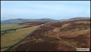
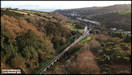
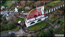
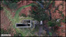
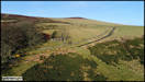
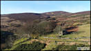
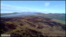
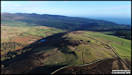
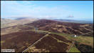
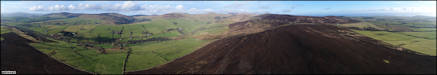
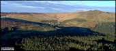
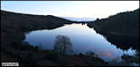
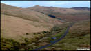
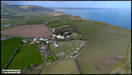
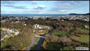
10th January
Creg-ny-Baa. DJI
Spark
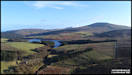
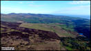
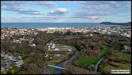
 12th January
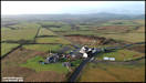
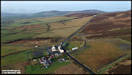
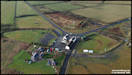
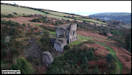
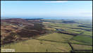
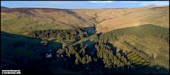
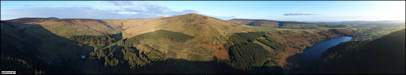
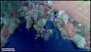
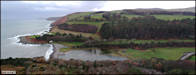
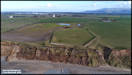
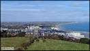
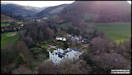
The Great Laxey Mine
and Agneash. DJI Spark
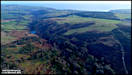
12th January
The Great Laxey Mine
and Agneash. DJI Spark
    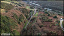
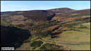
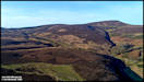
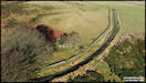
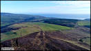
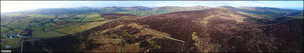
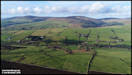
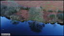
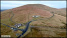
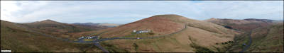
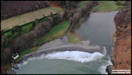
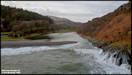
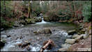
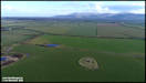
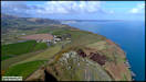
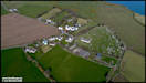
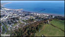
 18th January
Druidale, by Montpelier
Woodland. DJI Phantom 4 Pro
18th January
Druidale, by Montpelier
Woodland. DJI Phantom 4 Pro
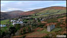
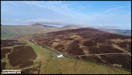
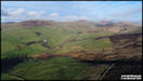
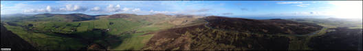
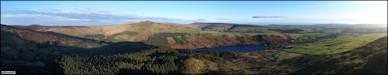
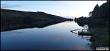
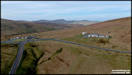
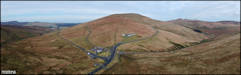
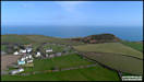
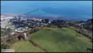
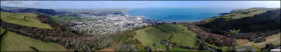
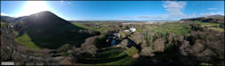
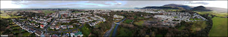
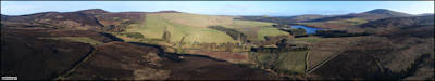 19th January
Creg-ny-Baa and Glen
Roy - DJI Phantom 4 Pro
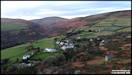
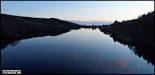
19th January
Creg-ny-Baa and Glen
Roy - DJI Phantom 4 Pro
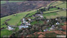
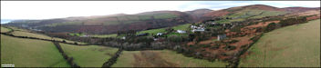
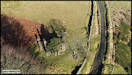
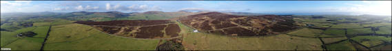
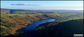
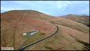
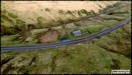
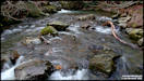
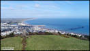
 Keppel Gate and the
East Baldwin Valley - Phantom 4 Pro
Keppel Gate and the
East Baldwin Valley - Phantom 4 Pro
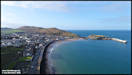
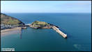
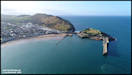
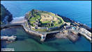
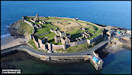
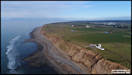
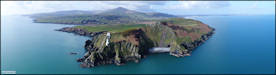
 20th January
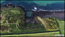
Peel Castle. DJI
Phantom 4 Pro
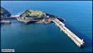
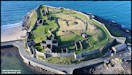
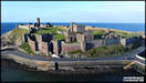
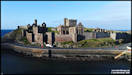
20th January
Peel Castle. DJI
Phantom 4 Pro
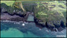
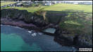
    Traie Fogog.
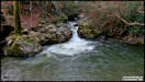
     22nd January
Injebreck/Colden area.
DJI Phantom 4 Pro
Colden Plantation Trail
22nd January
Injebreck/Colden area.
DJI Phantom 4 Pro
Colden Plantation Trail
   5th February
The Bungalow and Snaefell
DJI Spark
5th February
The Bungalow and Snaefell
DJI Spark
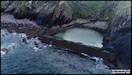
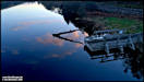
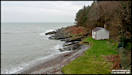
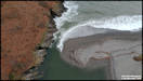
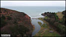
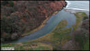
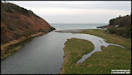
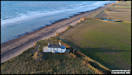
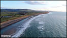
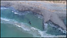
  14th February
Port Cornaa. DJI
Spark.
The tide was high for
the first flight (of four in total) and I've never seen the lagoon so full
of water before, it was getting quite close to the cottage that is normally
well behind. DJI Spark 14/2/20
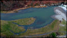
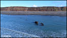
14th February
Port Cornaa. DJI
Spark.
The tide was high for
the first flight (of four in total) and I've never seen the lagoon so full
of water before, it was getting quite close to the cottage that is normally
well behind. DJI Spark 14/2/20
 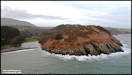   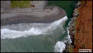
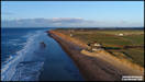
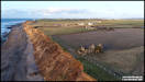
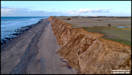
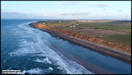
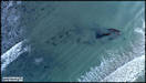
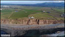
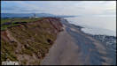
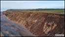
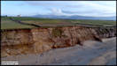
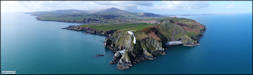
  27th February
Jurby Head. DJI
Phantom 4 Pro
27th February
Jurby Head. DJI
Phantom 4 Pro
 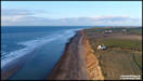   
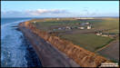   
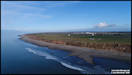
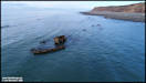
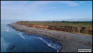
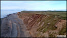
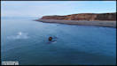
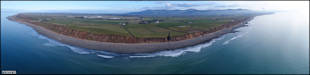
 5th March
Jurby Head (2)
DJI Phantom 4 Pro
5th March
Jurby Head (2)
DJI Phantom 4 Pro
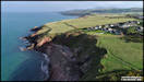
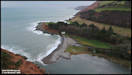
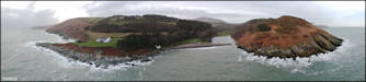
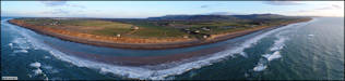
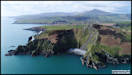
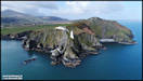
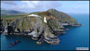
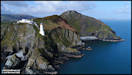
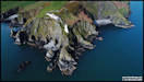
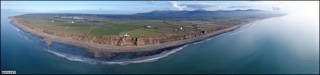  19th March
Maughold Head and the
village. DJI Phantom 4 Pro
19th March
Maughold Head and the
village. DJI Phantom 4 Pro
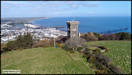
     Lherghy Frissell
and Albert Tower. DJI Phantom 4 Pro
Lherghy Frissell
and Albert Tower. DJI Phantom 4 Pro
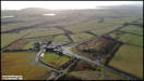
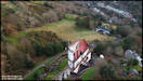
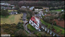
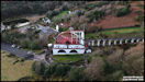
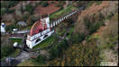
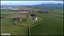
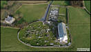
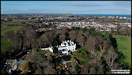
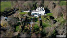
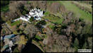
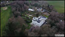
 20th March
Milntown House and Gardens.
DJI Spark
20th March
Milntown House and Gardens.
DJI Spark
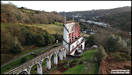
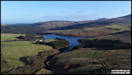
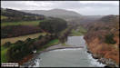
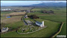
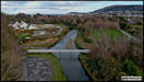
 Ramsey, from by the
White Bridge.
Ramsey, from by the
White Bridge.
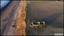
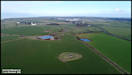
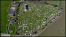
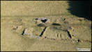
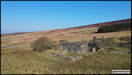
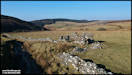
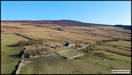
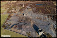
 25th March
Aerial pictures of three
tholtans, a chapel and a mine. Glen Rushen. DJI Spark
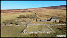
Two Tholtans
25th March
Aerial pictures of three
tholtans, a chapel and a mine. Glen Rushen. DJI Spark
Two Tholtans
 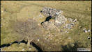  
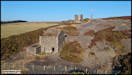
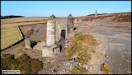
     The Chapel
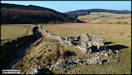
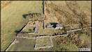
The 1870 Ordnance Survey
map show this as 'Wesleyan Methodist Chapel. In Frances Coakley's
'Manx Notebooks' it is mentioned (under 1902 Chapel returns) as seating
70. Maybe they were talking about another building but it doesn't look
big enough and why such a big chapel to serve a few upland farms.
It's suggested that it was owned by Beckwith's Mine, but it's not that
close to the mine and as far as I know the miners didn't live up here.
So a bit of a mystery.
The Chapel
The 1870 Ordnance Survey
map show this as 'Wesleyan Methodist Chapel. In Frances Coakley's
'Manx Notebooks' it is mentioned (under 1902 Chapel returns) as seating
70. Maybe they were talking about another building but it doesn't look
big enough and why such a big chapel to serve a few upland farms.
It's suggested that it was owned by Beckwith's Mine, but it's not that
close to the mine and as far as I know the miners didn't live up here.
So a bit of a mystery.
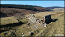
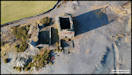
   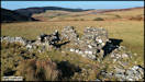 The third Tholtan, Claghbane.
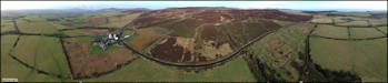
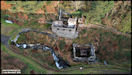
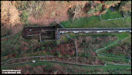
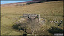
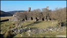
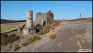
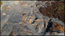
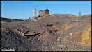
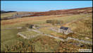   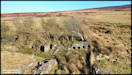  Beckwith's Mine
Lead was first discovered
here on the surface around 1830 and a mine started to recover it in 1831.
The mine was equipped with a steam engine to pump out water and eventually
reached a depth of 185 fathoms. It continued in production until
1879. (Laxey Mines Research Group).
There are considerable remains still on the surface although trail bike
riding has destroyed much over the years. The site is now closed
off to motor vehicles.
Beckwith's Mine
Lead was first discovered
here on the surface around 1830 and a mine started to recover it in 1831.
The mine was equipped with a steam engine to pump out water and eventually
reached a depth of 185 fathoms. It continued in production until
1879. (Laxey Mines Research Group).
There are considerable remains still on the surface although trail bike
riding has destroyed much over the years. The site is now closed
off to motor vehicles.
|